Estate Shutter Florida — Real Estate Photography South Florida

Florida Real Estate Photography — Miami, Orlando, Tampa & Fort Lauderdale

Estate Shutter Florida delivers professional HDR real estate photography, FAA-certified drone aerials, Zillow 3D virtual tours, AI virtual staging, and twilight photography for agents, brokers, and developers across South Florida (Miami-Dade, Broward, Palm Beach) and Central Florida (Orange, Hillsborough, Osceola counties). Founded by Mike Brun — FAA Part 107 certified drone pilot, 6+ years experience, 2,000+ MLS listings photographed. Photos starting at $199 with guaranteed 24-hour delivery.

Book Your Shoot View Packages & Pricing →

Call (786) 604-0823  ·  info@estateshutterfl.com  ·  Everyday 7am–7pm  ·  Miami, FL

Real Estate Photography Services

  • HDR Real Estate Photography — from $199

    Professional interior and exterior photography with 24-hour delivery. 25–50 fully edited photos. Sky replacement, color correction, object removal, and MLS-ready files included. Serving all of Florida.

  • FAA-Certified Drone Photography — from $199

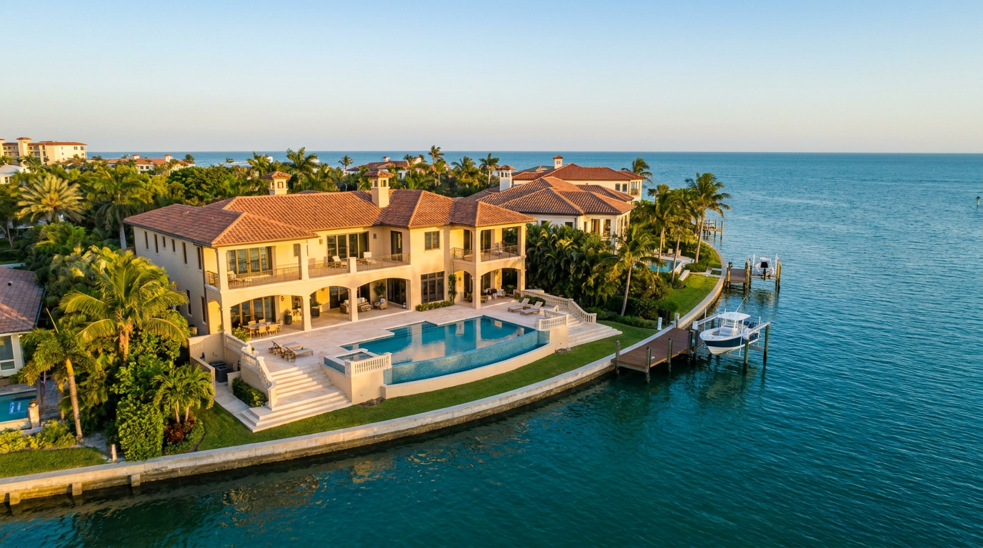
    Aerial photography and 4K video by FAA Part 107 certified pilots. Captures waterfront access, lot size, neighborhood context, and community amenities. Required airspace authorizations obtained before every flight.

  • Zillow 3D Virtual Tours — from $199

    Interactive 3D walkthroughs for Zillow, Realtor.com, and MLS. Listings with Zillow 3D tours generate 40% more inquiries and earn the Zillow "3D Home" badge. Ideal for international and remote buyers.

  • AI Virtual Staging — from $7/photo

    Transform empty rooms into furnished spaces using AI. 12 styles, results in ~15 minutes. Order online anytime without scheduling. Volume pricing: 1–5 photos $20, 6–10 photos $15, 11–15 photos $10, 16+ photos $7.

  • Twilight & Blue Hour Photography

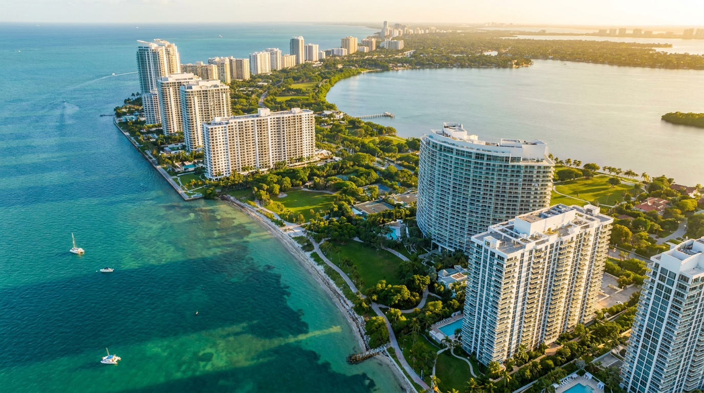
    Dramatic dusk exterior photography for luxury and waterfront listings. Particularly effective for oceanfront condos, Intracoastal estates, and high-rise penthouses with Miami or Fort Lauderdale skyline views.

  • Commercial Photography

    Architectural, office, retail, and construction progress photography for developers, architects, and commercial brokers. Serving Miami, Fort Lauderdale, Boca Raton, West Palm Beach, Naples, and Tampa.

Packages & Pricing

Transparent pricing — no hidden fees. 10% off for new clients. Pay only after approving your gallery.

Package Price Includes
Basic Photographyfrom $19925–35 HDR photos, 24-hr delivery, sky replacement, object removal
Standard Packagefrom $349Photos + drone aerials, 30–50 images, 4K drone stills & video
Pro Packagefrom $599Photos + drone + Zillow 3D tour + twilight + floor plan
AI Virtual Stagingfrom $7/photoOnline ordering, 12 furniture styles, results in ~15 min, volume discounts

See all packages and detailed pricing →

Real Estate Photography Service Areas — South Florida

We serve all of Miami-Dade, Broward, and Palm Beach counties with no travel fees.

Miami-Dade County

Broward County

Palm Beach County

Real Estate Photography FAQ — Florida

How much does real estate photography cost in Miami?

Packages start at $199 for 25–35 HDR photos with 24-hour delivery. Standard package (photos + drone) from $349. Pro package (photos + drone + Zillow 3D + twilight + floor plan) from $599. New clients get 10% off. Pay only after gallery approval.

How quickly will I receive my real estate photos?

We guarantee 24-hour delivery. Over 85% of galleries are delivered within 16 hours. Photos arrive via private online gallery with MLS-ready and high-resolution downloads. Rush same-day delivery available.

Are you FAA certified for drone photography in Florida?

Yes. All drone pilots hold FAA Part 107 Remote Pilot Certificates — legally required for commercial drone photography in Florida. We carry full liability insurance and obtain FAA airspace authorizations near all major Florida airports (MIA, FLL, PBI, MCO, TPA) before every flight.

What areas of Florida do you serve?

All of Miami-Dade, Broward, and Palm Beach counties in South Florida, plus the Orlando metro (Orange, Osceola, Seminole counties) and Tampa Bay (Hillsborough, Pinellas, Pasco counties) in Central Florida — 50+ cities statewide including Miami, Fort Lauderdale, Boca Raton, Orlando, Tampa, Windermere, Winter Park, and Lake Nona. No travel fees within each region.

What is a Zillow 3D virtual tour and why does it matter for Florida listings?

Zillow 3D creates a fully navigable 3D digital twin buyers can explore online from any device. It earns the Zillow "3D Home" badge and generates 40% more inquiries. Essential for Florida's international and remote buyers — particularly in South Florida's luxury markets and Central Florida's high-volume relocation markets.

About Estate Shutter Florida

Founded by Mike Brun, Estate Shutter Florida is Florida's premier real estate photography service, trusted by 1,300+ active realtors across South Florida and Central Florida. Mike holds an FAA Part 107 Remote Pilot Certificate, is a member of the Professional Real Estate Photographers Association (PREA), and is a Zillow Premier Partner. 6+ years of South Florida experience · 2,000+ MLS listings photographed.

Equipment: Sony α7R V · DJI Mavic 3 Pro (Hasselblad lens) · Zillow 3D Pro3 · Profoto B10X. Learn more →
Back to the Journal
Drone Photography

Elevate Your Listings: A Guide to Jacksonville Drone Photography

May 17, 2026Estate Shutter Team9 min read
drone photographyaerial real estate photosdrone video real estateaerial photographyJacksonville aerial videographyreal estate marketing Jacksonville
Elevate Your Listings: A Guide to Jacksonville Drone Photography

Why Aerial Photography is No Longer a Luxury in Jacksonville

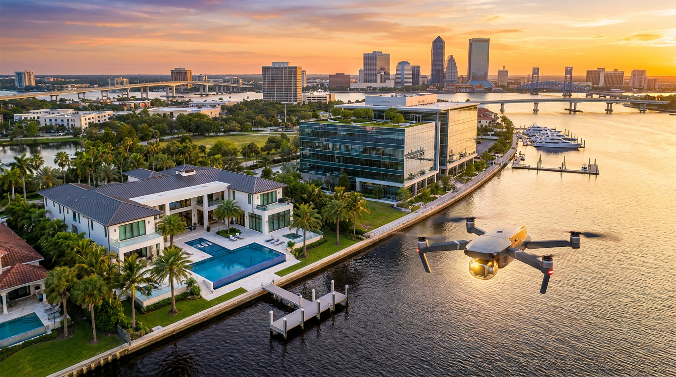
The unique character of Jacksonville—from the oceanfront estates of Ponte Vedra Beach to the sprawling properties along the St. Johns River—cannot be fully captured from the ground. Aerial photography provides the context and scale that standard images lack, offering a comprehensive view that helps buyers understand the full value of a property before they even step foot on it.

This is more than just a feeling; it's backed by data. As of May 2026, listings in the Jacksonville market featuring professional aerial photos sell, on average, 32% faster than those without. This statistic highlights a clear shift in buyer expectations. They want to see the property's layout, its proximity to water, the scope of the backyard, and its relationship to the surrounding neighborhood. Aerial shots deliver this information instantly and compellingly.

By showcasing a home’s location relative to parks, schools, amenities, and natural features, you are selling a lifestyle, not just a structure. A high-quality aerial image can transform a listing from a simple "house for sale" into a "waterfront retreat" or a "secluded family compound." This emotional connection is what drives faster offers and justifies premium pricing. While our core focus is providing exceptional professional real estate photography of all types, the power of an aerial perspective is undeniable.


The Technical Edge: What Sets Professional Drone Services Apart

With the proliferation of consumer drones, it can be tempting to think of aerial photography as a simple DIY task. However, the difference between amateur and professional results is vast and has significant implications for your business, reputation, and legal standing. Entrusting your listings to a proven expert is crucial for achieving the polished, high-impact results that attract serious buyers.

FAA Part 107 Certification: The Non-Negotiable

First and foremost, any commercial drone operation, which includes shooting real estate for a listing, legally requires the pilot to be certified under the FAA's Part 107 rules. This isn't just red tape; it ensures the pilot understands airspace regulations, weather patterns, and safety protocols. Working with an uncertified pilot exposes you, your brokerage, and your client to significant legal and financial risks. At Estate Shutter, all our pilots are FAA-certified, licensed, and insured, guaranteeing every shoot is conducted safely and professionally in the complex Jacksonville airspace.

High-End Equipment for Superior Results

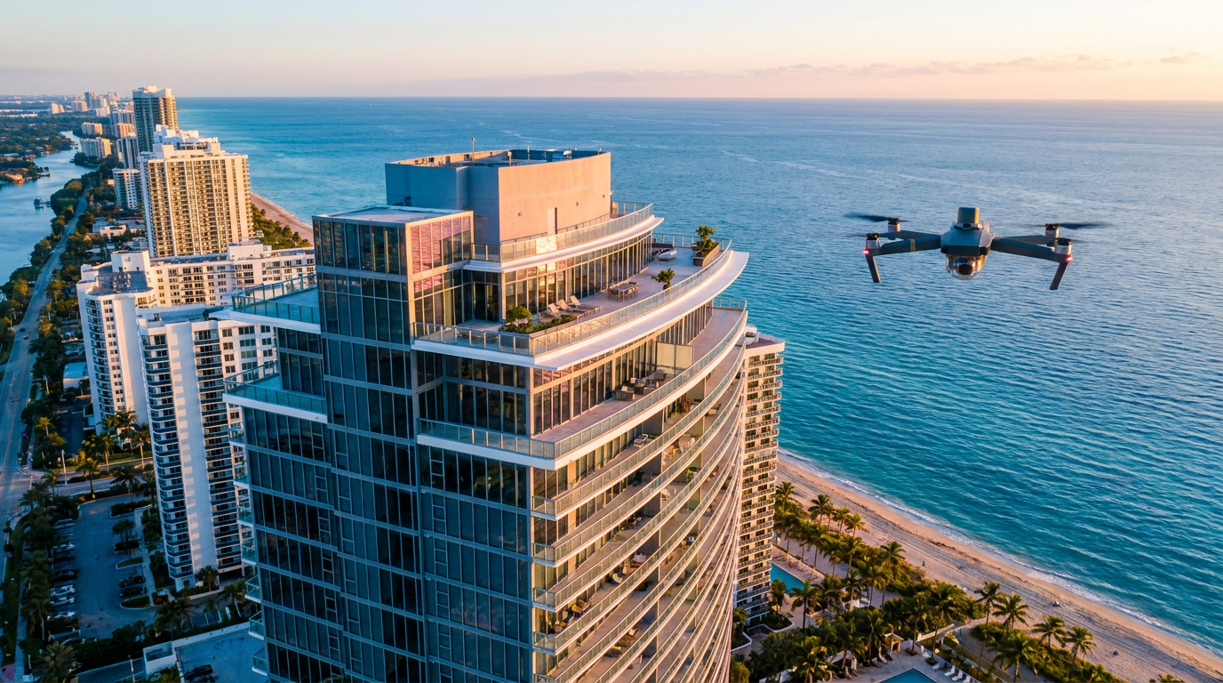
Professional drone photography services use equipment that far surpasses consumer-grade models. We utilize drones with high-resolution sensors, capable of capturing stunning 48MP+ raw images and crisp, stable 4K or 6K video. The use of advanced 3-axis gimbals ensures that every shot is perfectly smooth, even in breezy coastal conditions. This technical superiority means sharper images, richer colors, and cinematic video quality that makes your listing look like a high-end production, not a hobbyist's experiment.

The Art of Composition from Above

Beyond the technical and legal requirements, a professional drone pilot is also an artist. They understand composition, lighting, and how to find the most flattering angles for a property. It’s about more than just launching a drone; it’s about executing specific shots like a "top-down" view to showcase a pool and patio, an "orbital" shot to reveal 360-degree views, or a "reveal" shot that dramatically introduces the home from behind a line of trees. These carefully planned shots tell a story and create a visual narrative that captivates potential buyers and elevates the perceived value of your Jacksonville property.


Maximizing ROI with Drone Photography in Jacksonville's Diverse Neighborhoods

One of the greatest strengths of Jacksonville is the diversity of its neighborhoods and property types. From historic districts to new coastal construction, a one-size-fits-all marketing approach falls flat. Drone photography allows you to tailor your visual strategy to highlight the unique appeal of any property, no matter its location.

For a sprawling estate in Queen's Harbour or a horse farm in the surrounding rural areas, aerial shots are essential to convey the sheer size and scale of the land. In luxury communities like Ponte Vedra Beach or along the Intracoastal, drone photos can perfectly frame the home’s relationship to the water, highlighting docks, boat lifts, and stunning ocean views. A recent 2026 study by the Northeast Florida Association of Realtors found that luxury properties (over $1M) in Jacksonville featuring a drone video walkthrough services received 68% more online engagement than listings without one.

This advantage isn't limited to luxury homes. In historic neighborhoods like San Marco and Riverside, aerial views can showcase a property's proximity to charming shopping districts and parks. For homes in golf course communities like TPC Sawgrass, a drone can capture breathtaking views of the fairways right from the backyard. Even commercial properties in the bustling Southside or downtown Jacksonville benefit immensely from aerials that show parking availability, accessibility, and nearby attractions. By investing in targeted aerial imagery, you demonstrate an expert understanding of the property's specific value proposition, leading to a stronger return on your marketing investment.


Beyond Photos: The Power of Drone Video and 3D Tours

While high-resolution aerial stills are a powerful tool, the capabilities of modern drones extend much further. Integrating drone video and data into your marketing packages creates an immersive experience that truly sets a listing apart and provides unparalleled insight for out-of-town buyers looking to relocate to Jacksonville.

Cinematic drone video is the ultimate way to tell a property's story. By combining sweeping aerial shots with smooth, ground-level footage from our video walkthrough services, we can create a compelling 2-3 minute highlight reel that feels like a movie trailer for the home. Imagine starting with a dramatic shot flying in from the Atlantic Ocean, revealing the home’s beachfront location, then seamlessly transitioning to a tour of the interior. This narrative approach is incredibly powerful for engaging buyers on social media and in digital ad campaigns.

Furthermore, the data captured by drones is invaluable for creating comprehensive digital models of a property. By combining aerial perspectives with interior scanning, we can produce a stunning 3D virtual tour that allows a buyer to explore the home and its grounds from anywhere in the world. This is the next generation of the open house, providing a complete and accurate picture of the entire property. Offering a full suite of services, including aerials, video, 3D tours, and even floor plan services, allows you to present a complete and irresistible marketing package to your clients. Explore our real estate photography packages to see how you can combine these powerful tools for maximum impact.


Frequently Asked Questions

Is drone photography expensive?

While professional drone photography is an investment, it should be viewed in terms of return on investment (ROI), not cost. Given that listings with aerials sell significantly faster and often for higher prices, the service more than pays for itself. It's a high-impact marketing tool that elevates the perceived value of a property and attracts more serious buyers, ultimately saving you and your client time and money.

What happens if the weather is bad on the day of the shoot in Jacksonville?

Weather is a key factor in drone operations. As a professional service, we constantly monitor weather conditions. If rain, high winds, or low clouds are forecasted for your scheduled shoot, we will proactively contact you to reschedule for the next available clear day. Our policy is to never compromise on safety or quality, and our flexible scheduling ensures we capture your property in the best possible light.

How long does a typical drone photography session take?

A standard drone photography session for a residential property typically takes between 45 and 90 minutes. The exact duration depends on the size of the property, the complexity of the shots required (e.g., photos only vs. photo and video), and any specific client requests. We work efficiently to capture a wide variety of angles without disrupting your client’s schedule.

Are you insured for drone operations in Jacksonville?

Absolutely. We carry comprehensive liability insurance specifically for our aerial drone operations. This protects you, your client, and your brokerage against any potential incidents. We are happy to provide a certificate of insurance upon request, giving you complete peace of mind when you book a shoot with us.


Take Your Jacksonville Listings to the Next Level

The evidence is clear: in the competitive Jacksonville real estate market of 2026, professional aerial imaging is a critical differentiator. It allows you to showcase properties in their best light, provide unmatched context, and create a powerful emotional connection with potential buyers. From capturing the scale of a large estate to highlighting the lifestyle of a waterfront home, the benefits are immediate and substantial.

Don't let your listings get lost in the noise. By embracing this technology, you position yourself as a forward-thinking agent who invests in superior marketing to achieve superior results. Ready to make your Jacksonville listings soar above the competition? Learn more about our expert drone photography services and let our FAA-certified pilots help you secure your next sale.

Estate Shutter Florida

Ready to make your next listing the best on the market?

Professional real estate photography, drone, 3D tours & virtual staging across South Florida — from $199 with 24-hour delivery. 100+ five-star reviews from 550+ agents.

MB

Mike Brun

Founder & Lead Real Estate Photographer

Founder of Estate Shutter Florida — FAA Part 107 certified drone pilot and professional real estate photographer with 6+ years and 2,000+ South Florida listings shot. More about Mike →