Aerial photography & 4K drone video
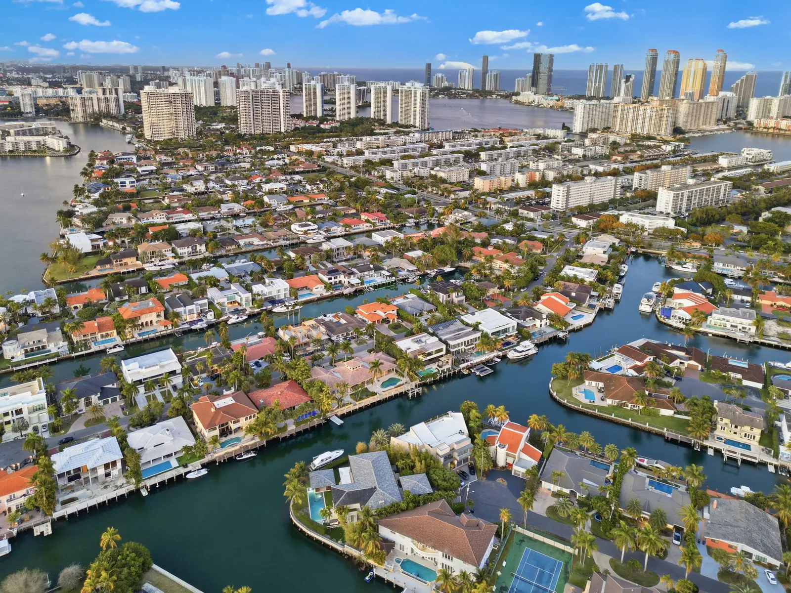
Real Estate Drone Photography in South Florida
The frame that sells the lot, the dock and the water before a buyer reads a word. Flown by FAA Part 107 pilots, with the airspace at your address checked before you book.
- FAA Part 107 pilots
- LAANC filed for you
- Delivered in 24 hours
Why it matters
Why drone photography sells Florida listings
Ground photos can’t show what a Florida buyer is paying for. In South Florida the value is often outside the walls — the water, the dock, the lot, the view. If the listing can’t show it, the buyer has to take your word for it.
- 01
Water access is invisible from the driveway
A dock, a seawall and a no-bridge run to the Intracoastal are worth real money. Only an aerial shows the route from the backyard to open water.
- 02
Lot size and privacy get lost at eye level
Acreage, golf or preserve frontage and the distance to the neighbors only read from above. That is exactly what a luxury buyer is comparing.
- 03
Penthouses sell height, skyline and exposure
A penthouse is priced on its elevation, the skyline it looks at and the way its terraces face. Drone angles show all three — the building’s position, the view from the top floors and the balcony exposure — across Miami, Fort Lauderdale and Palm Beach.
- 04
Location sells condos and towers
For a high-rise, the selling point is where the building sits — the beach, the bay, the skyline. An elevated frame puts the unit in context, and the rooftop, pool deck, amenities and nearby coastline show the lifestyle the monthly fee pays for.
- 05
Remote buyers judge the location from the air
Florida draws buyers from other states and overseas, and many shortlist before they ever drive past the property. An aerial answers what a street view can’t: how far the beach really is, where the marina sits and what is next door.
- 06
An illegal flight is a liability, not a shortcut
Most of South Florida sits in controlled airspace. An uncertified operator can put your listing and your brokerage at risk. Ours file authorization for every flight.
Recent aerial work
Drone photography portfolio: South Florida aerials
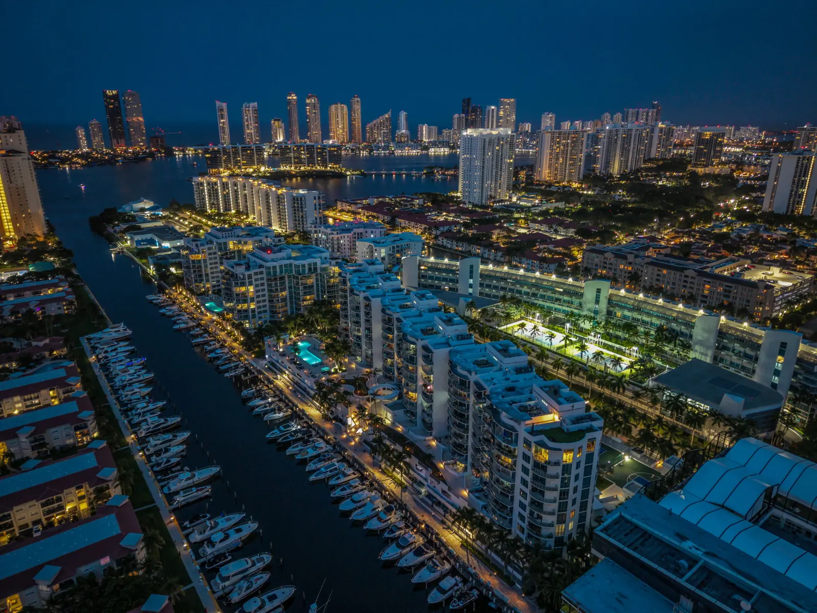
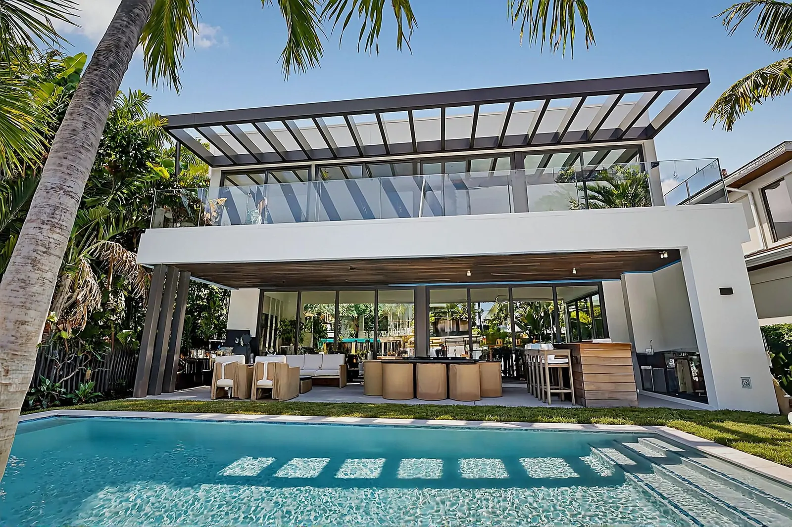
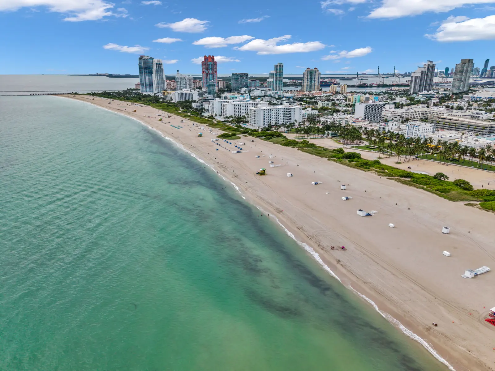
Real estate drone photography from recent Estate Shutter shoots: canal homes, oceanfront towers, modern estates and skyline context across Miami-Dade, Broward and Palm Beach — the frames that show scale, water access and where a property sits. Tap any frame to view it full size.
What you get
What our drone photography service includes
No separate drone vendor, no chasing files, no airspace homework on your side.
- Included
Edited aerial stills
Listing-resolution aerials for the MLS plus a full-resolution set for print and brochures.
- Standard +
4K aerial video
On Standard and Pro, aerial footage is cut into the cinematic walkthrough — not delivered as raw clips.
- Waterfront
The waterfront sequence
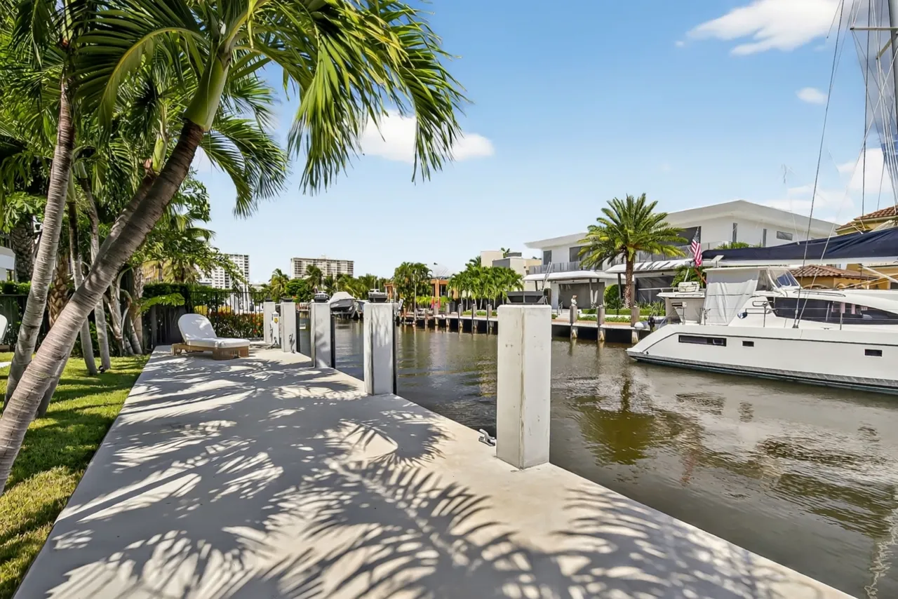
Dock, seawall and a run along the canal or waterway toward open water — the shot that sells boat owners.
- Included
Lot & location context
Frontage, boundaries, golf or preserve views and where the home sits relative to the beach, bay and city.
- Condos
Tower, rooftop & amenity aerials
For condo and penthouse listings: the building exterior, rooftop, pool deck and amenities, and the coastline around them — flown from a launch site the association permits.
- Included
Lot orientation, shown accurately
Framed so a buyer can see which way the home faces and how the pool, lanai and outdoor areas sit on the lot — represented as they are, never exaggerated.
- Included
Shoreline & skyline framing
Angles composed so the ocean, the bay or the skyline sits behind the property instead of being cropped out, with the flight timed to the light — midday, sunset or twilight.
- Done for you
Airspace check & LAANC
We check the grid for your exact address and file authorization. If it can’t be flown, you hear it before you book.
- On request
Twilight aerial option
A planned blue-hour session for luxury and waterfront listings — the strongest frame this market produces.
- Included
Licensed & insured
Certified remote pilots with liability insurance. A certificate of insurance is available for your HOA or condo board.
- 24 hrs
One gallery in 24 hours
Aerials arrive in the same gallery as the rest of the shoot. Nothing to chase separately.
How it works
How a real estate drone shoot works
- 1
Book & we check the air
Book online or by phone. We check the LAANC grid, TFRs and local launch rules for your address before confirming.
- 2
Authorization filed
Your pilot files LAANC authorization for the flight window and plans the shot list around the property’s selling points.
- 3
Flown with the shoot
Aerials are captured on the same visit as the photos and video, timed for the best light on the facade and water.
- 4
Delivered in 24 hours
Galleries are delivered within 24 hours of the shoot. MLS-ready and full-resolution, in one link.
South Florida airspace
Can you legally fly a drone over a South Florida listing?
Usually yes, with authorization — but “usually” is doing real work in that sentence. Most of the tri-county area sits inside controlled airspace generated by one of nine airports, and the maximum altitude an automated authorization will grant varies grid by grid, block by block. This is the table we check before quoting an aerial — followed by what we plan for in each South Florida market, who flies your listing and where we fly.
| Airport | Class | Markets it affects |
|---|---|---|
| Miami International (MIA) | B | Most of Miami, Miami Beach, Coral Gables, Doral, the barrier island |
| Fort Lauderdale-Hollywood (FLL) | C | Fort Lauderdale, Dania Beach, Hollywood |
| Palm Beach International (PBI) | C | West Palm Beach, Palm Beach island, Lake Worth Beach |
| Fort Lauderdale Executive (FXE) | D | Coral Ridge, Galt Ocean Mile, Oakland Park, Wilton Manors |
| Boca Raton (BCT) | D | Downtown Boca, eastern Boca communities, Highland Beach |
| Opa-locka (OPF) | D | North Miami, Miami Gardens, Miami Lakes |
| Miami Executive (TMB) | D | Kendall, Pinecrest, Palmetto Bay |
| North Perry (HWO) | D | Pembroke Pines, Miramar, western Hollywood |
| Pompano Beach Airpark (PMP) | D | Pompano Beach, Lighthouse Point |
LAANC authorization
LAANC (Low Altitude Authorization and Notification Capability) is the FAA system that grants near-instant approval to fly in controlled airspace around an airport. Approval is usually near-instant, but only up to the ceiling published for that grid. A zero-foot grid needs a further-coordination request filed well in advance.
Temporary flight restrictions
VIP TFRs over Palm Beach island appear at short notice and can reach across the Intracoastal into West Palm Beach. A TFR is absolute — no authorization overrides it. We check the day before and the morning of, and reschedule the aerial free if one is active.
Local launch rules
Federal authorization governs the airspace, not the ground. Miami Beach restricts launching from city parks and public beach, and many condo associations prohibit launching from their property. We arrange a compliant launch site in advance.
Brickell & Downtown Miami
Skyline and rooftop frames sell towers here. Brickell sits under the MIA Class B shelf, where the authorized ceiling can change block by block, so we confirm the altitude for the exact building before quoting — and if a flight isn’t available, we propose an elevated-floor or rooftop alternative rather than quietly dropping the aerial.
Coral Gables & Coconut Grove
Gables estates sell on architecture and grounds, so the aerials are elevation and detail shots: the roofline, the courtyard, the canopy and the lot. In Coconut Grove the frame that matters connects the home to the bay and the marinas. Both sit inside MIA’s Class B airspace, so every flight is authorized first.
Key Biscayne & Miami Beach
On the islands, privacy and the beach are the product: the setback from the neighbors, the water on either side and the walk to the sand. Launch sites are planned ahead — Miami Beach restricts launching from city parks and public beach.
Fort Lauderdale canals
Boating and canal visuals sell here: the dock, the seawall and the route along the canal toward the Intracoastal. Coral Ridge and Galt Ocean Mile sit under Fort Lauderdale Executive’s Class D airspace; most of the rest of the city under Fort Lauderdale-Hollywood’s Class C.
Palm Beach & West Palm Beach
Island estates sell on frontage, grounds and privacy. Palm Beach is also where VIP temporary flight restrictions appear at short notice, so the aerial is checked the day before and the morning of, and rescheduled free if a TFR is active.
Who flies your listing
Every Estate Shutter FL photographer holds an FAA Part 107 remote pilot certificate, and each certificate can be checked by number through the FAA Airmen Inquiry database — ask for the number of the pilot assigned to your shoot. Aerial work is flown by FAA Part 107 certificated remote pilots; LAANC authorisation is filed by the pilot before every controlled-airspace flight. Liability insurance is carried on every flight.
Where we fly
Across Miami-Dade, Broward and Palm Beach counties, with no travel fee. Miami-Dade: Miami Beach, Brickell and Downtown, Coral Gables, Coconut Grove, Key Biscayne, Fisher Island, Sunny Isles Beach, Aventura, Bal Harbour and Surfside. Broward: Fort Lauderdale and Las Olas, Hollywood, Hallandale Beach, Pompano Beach, Lighthouse Point, Weston, Davie, Plantation and Deerfield Beach. Palm Beach: Palm Beach, West Palm Beach, Boca Raton, Highland Beach, Delray Beach, Jupiter, Wellington and Palm Beach Gardens.
Airspace classifications last reviewed September 17, 2026. Airspace and TFRs change — the authoritative check is made against current FAA data on the day of every flight.
Packages
Drone photography pricing and packages
Drone is built into the packages agents book most. Aerials come standard on Standard and Pro, alongside photos, video and a floor plan. Prices scale with square footage — no travel fee across the tri-county area.
Standard
Complete property showcase with drone footage.
from$399
0–1,500 sqft · scales with square footage
- FAA Part 107 drone aerials
- 50–60 HDR photos + 4K cinematic video
- 2D floor plan with measurements
Pro
Premium luxury marketing suite.
from$699
0–1,500 sqft · scales with square footage
- Drone + community aerial footage
- 60–70 HDR photos + 3-min cinematic tour
- Zillow 3D / Zillow 3D virtual tour
On a Basic package? Aerials can be added when you book. Compare every package and size
Our guarantee
You love the photos, or you don't pay.
100% satisfaction
Not right? Free re-shoot or a full refund.
24 hours, or the next one's free
Miss the deadline and your next shoot is free.
Pay after you approve
Book by phone and pay once you've seen the gallery.
Guarantees are subject to our terms of service.
In their words
Hear it from a Realtor who books us.
Craig Anderson, Realtor, on working with Estate Shutter.
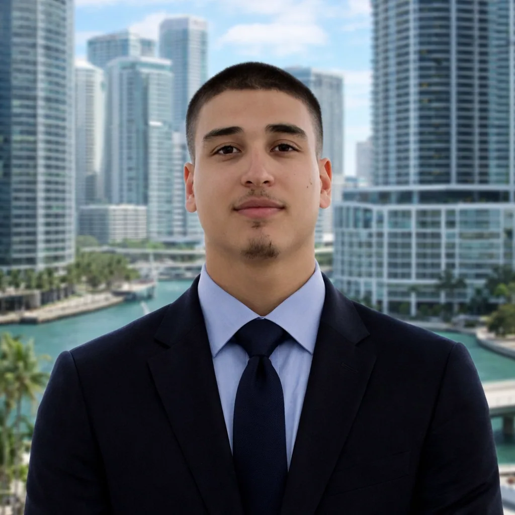
Mike BrunFounder & Lead Real Estate Photographer · FAA Part 107 certified
Answers before you book
Drone photography FAQ
Still unsure? Call (786) 604-0823 and talk to our team directly.
Drone aerials are included in the Standard package, which starts at $399 for a listing under 1,500 square feet and covers photography, aerials and a video walkthrough together. They can also be added to the Basic package, which starts at $199. Pricing scales by square footage, there is no travel fee inside Miami-Dade, Broward or Palm Beach, and phone bookings are invoiced after gallery approval; online: 20% deposit, balance after delivery.
Aerial work is flown by FAA Part 107 certificated remote pilots; LAANC authorisation is filed by the pilot before every controlled-airspace flight. A Part 107 remote pilot certificate is the legal requirement for commercial drone operation in the United States, and anyone can verify one through the FAA Airmen Inquiry database — ask us for the certificate number of the pilot assigned to your shoot. We also carry liability insurance and can provide a certificate of insurance on request.
LAANC (Low Altitude Authorization and Notification Capability) is the FAA system that grants near-instant approval to fly in controlled airspace around an airport. Most of South Florida sits inside controlled airspace, so LAANC is the difference between a legal flight and an illegal one. Each airspace grid carries a maximum approved altitude, which can be 400 feet, 100 feet, or zero. We check the grid for your exact address before the shoot.
Miami International (MIA) generates Class B airspace covering most of Miami and the barrier island. Fort Lauderdale-Hollywood (FLL) and Palm Beach International (PBI) each generate Class C airspace over their cities. On top of those sit several Class D fields whose airspace covers dense residential areas: Fort Lauderdale Executive (FXE), Boca Raton (BCT), Opa-locka (OPF), Miami Executive (TMB), North Perry (HWO) and Pompano Beach Airpark (PMP). Homestead Air Reserve Base restricts the far south of Miami-Dade. In practice, a majority of South Florida listings sit in controlled airspace.
Three reasons, in order of frequency. First, the LAANC grid for that address has a zero-foot ceiling, which requires a further-coordination request filed well in advance rather than instant approval. Second, a temporary flight restriction — most commonly a VIP TFR over Palm Beach island, which no authorisation overrides and which can appear at short notice. Third, local rules: Miami Beach restricts launching from city parks and public beach, and some condo associations prohibit launching from their property. We check all three before confirming.
Often, but it is address-specific and has to be checked rather than assumed. Brickell sits under the MIA Class B shelf where ceilings vary block by block. Palm Beach island carries the TFR problem described above. In both cases, if a flight is not available we will say so up front and propose an elevated-floor or rooftop alternative rather than quietly dropping the aerial.
Edited aerial stills at listing resolution plus a full-resolution set, and on Standard and above, 4K aerial video cut into the walkthrough. For waterfront properties that includes the dock, the seawall and a sequence following the canal or waterway toward open water. For golf and acreage properties it includes the frontage and the boundary.
Galleries are delivered within 24 hours of the shoot. Aerial stills and video are delivered in the same gallery as the rest of the shoot, so there is nothing to chase separately.
Miami-Dade, Broward and Palm Beach counties, with no travel fee — Miami, Miami Beach, Coral Gables, Coconut Grove, Key Biscayne, Aventura, Sunny Isles, Fort Lauderdale, Hollywood, Pompano Beach, Weston, Boca Raton, Delray Beach, West Palm Beach and Palm Beach among them.
Yes, and they are the strongest frame this market produces on waterfront and luxury listings. The usable blue-hour window is roughly 20 minutes, so a twilight aerial is booked as a planned session with the LAANC authorisation timed to cover it, not attempted opportunistically at the end of a daytime shoot.
Drone photography guides for Florida agents
- Drone Photography for Real Estate in South Florida: What Agents Need to KnowAerials, airspace and the rules to know before you book a drone shoot.
- Real Estate Twilight Photography: Why Dusk Shots Sell South Florida Luxury HomesWhy blue-hour frames make high-end listings stand out.
- Miami real estate photographyPhotography, video and aerials for Miami-Dade listings.
Cities We Serve
Professional real estate drone photography across Miami-Dade, Broward and Palm Beach counties. Pick your city for local coverage, pricing and recent work.
Don't see your city? We serve all of Miami-Dade, Broward and Palm Beach counties. Contact us for service in your area.
Pairs well with
Services to pair with drone photography
Book real estate drone photography in South Florida
Give your next listing the view it deserves. Tell us the address. We’ll check the airspace, confirm the shot list and have aerials in your inbox within 24 hours of the shoot.
10% off Standard & Pro on your first shoot — code FIRSTSHOOT